
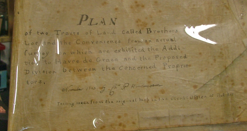
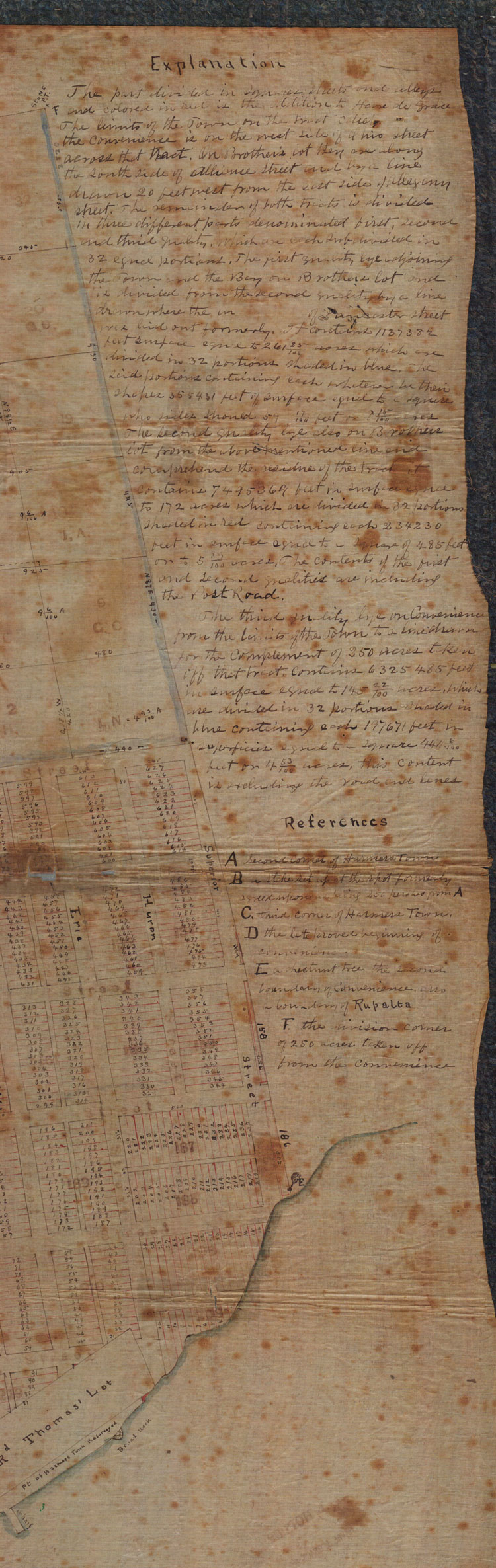
1858 map Harford County and 1803 map referencing Harmers Town
Harford County 1858 Map
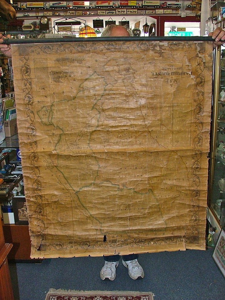
This map was published by Jennings & Herrick entirely from original surveys. It includes an inset of Havre de Grace Streets. (yep, we know it’s upside down. It is so fragile that we didn’t want it to tear,)
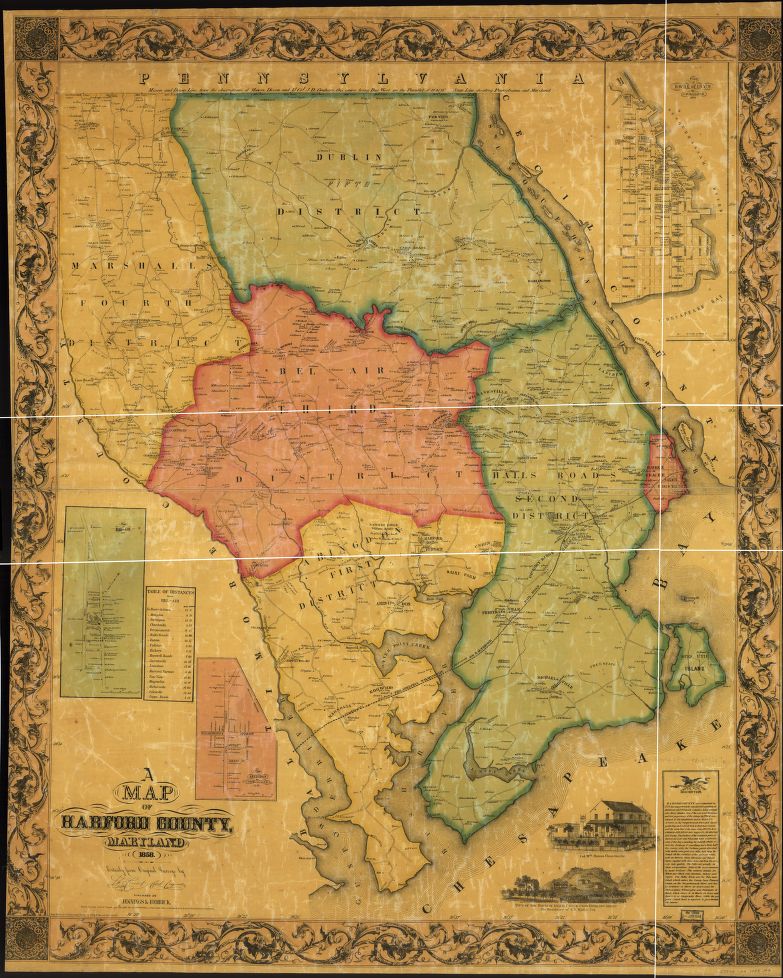
Posted above is a better photo from Herrick, L. W. A map of Harford Co., Maryland, 1858. [Philadelphia?, Jennings & Herrick, 1858] Map. Retrieved from the Library of Congress, website. (Accessed July 12, 2017.)
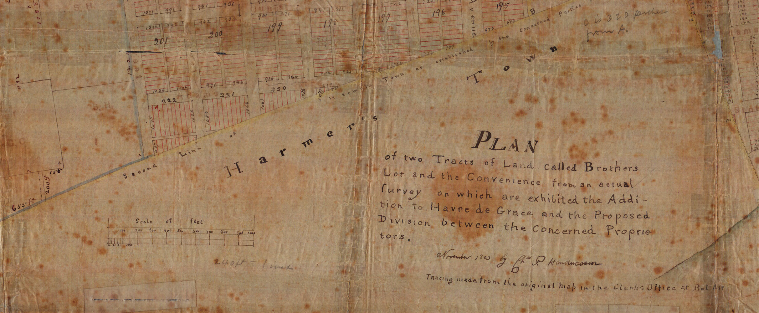
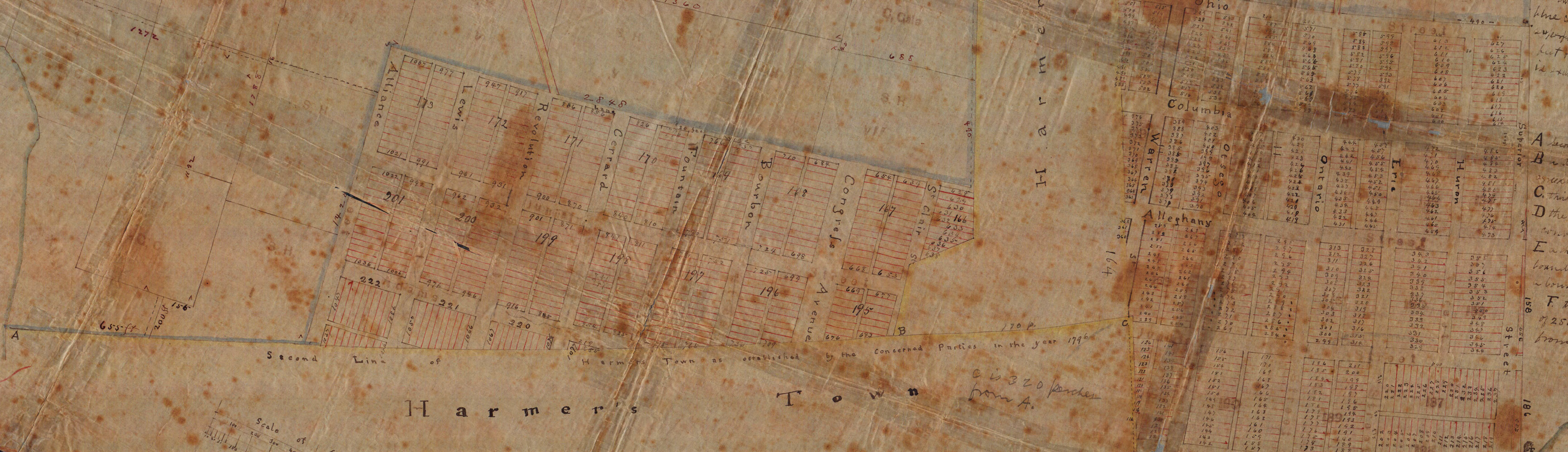
George also has an 1803 map regarding “Harmers Town as established by the concerned parties in the year 1796”
Made from tracings from the original maps in the clerks office at Bel Air, Nov. 1803. Below are some great snapshots of the map

Stop by Bahoukas Antique Mall to view many historic pieces related to Havre de Grace history. Many are not for sale, but George has plenty of stories to make it worth your while. Of course, we have 9,000 sq ft of antiques and collectibles plus another 2,200 sq ft of browsing in the Beer MuZeum (and yes, most of this IS for sale). We’ll be watchin’ for ya!
